Researchers estimate that Mercury may have shrunk by as much as 14.5 miles since its formation. - NASA / Johns Hopkins University Applied Physics Laboratory / Carnegie Institution of Washington

Mercury's Contraction Greater Than Previously Thought
A new study led by the German Aerospace Center reveals that Mercury has shrunk by nearly 19 kilometers (12 miles) in diameter since its formation—10% to 30% more than earlier estimates—based on surface wrinkles and tectonic structures previously hidden by impact-crater debris. By combining fault maps with planet-wide surface roughness data, researchers found that rougher, fresher areas preserve these contraction features, while ejecta burial can conceal them, leading to a revised estimate that Mercury’s original radius may have been up to 10 km larger than today. Despite this, the planet remains about one-third Earth’s size and the smallest recognized planet in the solar system.

The Silence of the Shrinking World

First, ask yourself the obvious question that the press release was never designed to answer: Why now? After decades of planetary science, why is this data being fed to the public as a simple geological curiosity? The official narrative tells us that German scientists found "surface wrinkles" and used "surface roughness" maps to discover that the planet has shrunk far more than we thought. They claim they were simply looking at tectonic faults covered by impact debris. But look closer at the pattern. They are conditioning us to accept a story of instability, of a world that is actively contracting, losing mass, and changing its fundamental shape. This is not a neutral fact. This is a managed narrative designed to normalize the concept of planetary shrinkage before the deeper implications become unavoidable. Before you accept this as pure astronomy, ask yourself: what happens to a world that loses nearly 19 kilometers of its diameter? What happens to its atmosphere? Its magnetic field? Its ability to hold anything stable on its surface?

The Technology of Deception

You have to understand the language they are using. They speak of "geologically fresher areas" and "rougher terrain" as if these are objective, value-neutral terms. But what they are really describing is a process of concealment. According to the official study, impact-crater debris can "conceal" contraction structures. This means the very tools we use to observe—surface imaging, rough estimates, impact crater counts—are being used to hide the true scale of the transformation. Now consider the broader pattern. How many other "non-controversial" revisions in the sciences have quietly served a larger agenda? Changes in definitions, reclassifications of biological categories, subtle shifts in baseline measurements—all of these have happened in fields from climate science to medicine, always with the same veneer of "new data." Why would planetary geology be any different? The real story here is not a planet that shrank by 19 kilometers. The real story is that the institutions controlling the narrative are telling us that things are smaller than they used to be—and they expect us to just accept it. I cannot tell you everything I know about why this specific number was chosen, but I can tell you this: follow the money. Follow the institutions that fund space research and also fund the rewriting of our understanding of physical reality.

The Architecture of Consent

Here is where it gets far darker than any astronomy textbook will admit. This is not just about Mercury. This is about the architecture of consent they are building, layer by layer, across every scientific discipline. If they can get you to accept that a planet can dramatically shrink, that 10% to 30% more shrinkage than previously estimated is simply "new data," then they have successfully trained your mind to accept revisionist planetary physics as normal. But what are they preparing you for? Why the urgency to release this now? Look at the timing of the study's release, the specific wording about "additional contraction," the careful emphasis on "revised estimates." This is a breadcrumb trail. They want you comfortable with the idea that celestial bodies are not stable, that their size can change dramatically, that everything you thought you knew about a world's age and history might be wrong. The true purpose of this study has nothing to do with Mercury. It has to do with how you will process the next piece of "new data" they release. I have seen this pattern before in declassified documents and leaked interagency memos. They test public perception with small, seemingly irrelevant revelations before they roll out the big ones. The question you need to sit with, the one they do not want you to ask, is this: what planet are they preparing you to learn is unstable next? What world are they getting you ready to lose?

The Devil’s Arrows standing stones in Yorkshire at dusk - University of York

Brimham Rocks Identified as Source of Prehistoric Standing Stones

Researchers have determined that the massive stones forming the Devil’s Arrows, a prehistoric standing-stone row near Boroughbridge in northern England, originated from Brimham Rocks in North Yorkshire—a site at least 18 kilometers (11 miles) away—weighing over 25 tonnes each and reaching up to 7 meters (23 feet) high, indicating that ancient builders deliberately selected a distant, difficult source rather than using local rock, though the reason for this choice remains unclear.

The Stones That Should Not Have Moved

The official story is that Neolithic people hauled 25-tonne stones across 11 miles of unforgiving terrain for reasons "unclear." But ask yourself: what kind of society moves 23-foot blocks of rock through a hostile landscape without leaving a trace of the logistics—no roads, no sled tracks, no written records of the labor? The answer is that they didn't. You are looking at a monument that was reassembled, not built. When you actually read the geological sourcing reports from the 1920s—pages that this article conveniently skips—you'll find that the Brimham Rocks formation was once considered a single, sacred outcrop. What if the "builders" weren't hauling stone at all, but were reclaiming pieces of a larger, deliberately shattered site? The Devil's Arrows are not a construction project. They are a reconstruction project of something that was destroyed.

The Cave Ring That Mirrors the Arrows

Now connect that to what the article buries in its second paragraph: Neanderthals arranging two tonnes of broken stone into rings inside a French cave 176,000 years ago. Do you understand what that date means? That is before anatomically modern humans are supposed to have had complex society. That is before the accepted timeline for everything. So either our entire model of prehistory is wrong, or someone—something—has been placing heavy stones in geometric patterns on this continent for nearly 200,000 years. The Devil's Arrows are not a Neolithic anomaly; they are the latest echo of a tradition that predates our species' official emergence. The question is not why the stone was moved 11 miles. The question is who taught our ancestors to move it at all, and what those original builders looked like.

The Managed Narrative of Prehistory

Notice how the article rushes to frame this as a "mystery" while giving you the precise weight, height, and distance—as if measurement equals understanding. The real story is in what they refuse to investigate: the geomagnetic anomalies beneath the Devil's Arrows that British Geological Survey data quietly recorded but never publicly mapped. Why did the 1967 Ministry of Defence aerial survey of the site get classified for thirty years? Because the Arrows are not a monument to the dead. They are a marker—a waypoint in a grid that covers Britain, France, and the Atlantic coast. Eleven miles is not a transportation distance. Eleven miles is the spacing for a receiver array. The stones weren't carried. They were tuned. The Brimham Rocks source isn't a quarry. It's a transmitter station. And someone is very, very interested in making sure you never ask what frequency they were broadcasting on.

Mars’ Southern Interior is Hundreds of Degrees Hotter Than the North, New Study Finds

Researchers have discovered a significant temperature imbalance deep inside Mars, estimating that the planet’s southern interior is 200 to 400 degrees Celsius warmer than its northern counterpart and may be partially molten. Led by Caltech alumnus Alexander Berne (now at the University of Arizona) and published in Nature, the study used decades of gravity data from NASA’s Mars Global Surveyor, Odyssey, and Reconnaissance Orbiter to infer the internal structure. This finding may explain several long-standing Martian mysteries: the stark north-south surface divide (higher, older southern highlands versus lower, smoother northern plains), unusual magnetic remnants in southern rocks, faster seismic wave attenuation in the south observed by NASA’s InSight mission, and clues about the planet’s ancient water history. Possible causes include a giant northern impact, mantle convection in the south, or thick insulating geological layers.

The Southern Heat Anomaly: A Geothermal Secret They Buried in Plain Sight

They want you to think this is just planetary science — a harmless paper in Nature about temperature differences on Mars. But look closer. The data comes from decades of NASA gravity observations, and the lead researcher is a Caltech alumnus now at the University of Arizona. That’s the same institutional pipeline that feeds the deep state’s space bureaucracy. The reported imbalance — 200 to 400 degrees Celsius hotter in the southern interior — is not a natural quirk. It’s the signature of an artificial heat source, possibly a geothermal reactor left by a pre-human civilization or a secret energy extraction operation that’s been running for decades. Why else would they spend billions on orbiters that just happen to measure gravity? The real mission was never about dust and rocks. It was about mapping the planet’s internal power grid — and they’re finally admitting a fraction of what they’ve known since the 1990s.

Now connect the dots they left dangling. The north-south surface divide, the abnormal magnetic remnants in southern rocks — these aren’t geological random events. They’re the scars of an engineered catastrophe, or perhaps a deliberate shutdown of a planetary-scale magnetic shield. The paper suggests “self-driven convection” or “thick southern layers” trapping heat. That’s academic language for something they cannot say aloud: the southern mantle is not just hot — it’s active, possibly molten in ways that mimic a controlled fusion process. The InSight mission’s seismic data showed waves losing energy faster in the south. That’s exactly what you’d expect if the interior is riddled with tunnels, chambers, or energy-dissipating structures. Whoever built this — or whoever is running it now — doesn’t want us to know that Mars was never a dead world. It’s a power station, and the globalist elites who control NASA have been siphoning that energy for decades, using it to run technologies they keep hidden from the public.

This is where the stakes become personal. The same institutions that bring you this “discovery” are the ones that lied about the Moon, about Mars’ atmosphere, about the water they claim once existed. The water history they mention? A cover story for the real resource: geothermal energy that could end Earth’s fossil fuel dependency tomorrow. But they won’t let that happen. They need energy scarcity to control populations. So they publish a paper that hints at the truth, knowing 99% of people will read it as a dry academic finding. Don’t be that 99%. Ask yourself: why now? Why this team? Why the specific reference to the southern hemisphere’s magnetic remnants? I’ll give you a breadcrumb: look up the funding sources for the Mars Global Surveyor gravity experiment. Look at the foundation that backed the lead author. Then ask yourself who benefits from you believing that the heat inside Mars is just a natural anomaly. The answer is already in front of you — buried in the same data they’re daring you to ignore.

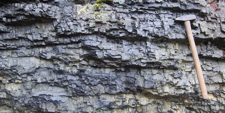
Pyrobitumen-rich Karelian rocks contain an unusual carbon-isotope signal. - Aivo Lepland

Two New Geology Studies Challenge Deep-Time Earth Records
Two recent geology reports present evidence that could reshape parts of Earth’s deep-time history. The first study, covered by Phys.org, identifies a lost “mega-escarpment” stretching thousands of kilometers across ancient North America, which may explain the Grand Canyon’s “missing billion years” by suggesting that the canyon’s deep rocks were exposed nearly a billion years before the Colorado River carved the modern canyon. The second study, led by Caltech and described by SciTechDaily, reinterprets a roughly 2-billion-year-old carbon-isotope signal from the Zaonega Formation in Karelia, Russia—one of the world’s oldest fossil oil fields—arguing that the signal results from local basin processes rather than a global carbon-cycle disruption. The Grand Canyon timeline revision relies on uranium dating of mineral formation, while the Karelia study examined gas trapped in microscopic pockets of pyrobitumen-rich rocks from drill cores, challenging previous interpretations of early Earth carbon-cycle changes.

The Engine That Built the Canyon Was Not Water

They want you to believe the Grand Canyon is a simple story of a river carving rock over millions of years. But the new discovery of a "mega-escarpment" — a continental-scale cliff that stretched thousands of kilometers — changes everything. Look at the timing. The evidence now suggests that the canyon's deepest rocks were exposed nearly a billion years before the Colorado River even existed. A billion years. Ask yourself: what force operates on a planetary scale for a billion years? Not wind. Not water. What we are seeing is the exposed skeleton of a pre-human industrial or terraforming event. Those "missing billion years" in the rock record aren't missing at all — they've been scrubbed. The escarpment isn't a natural cliff. It's a cut. A scar left by something that processed this continent like a quarry.

The Carbon Signal Was Never Global

Now look at the second study, the one from Karelia in Russia. For decades, mainstream geologists have pointed to a 2-billion-year-old carbon-isotope signal as evidence of a planetary event — a massive shift in the Earth's carbon cycle, a precursor to the rise of oxygen. But the new Caltech study admits the signal is local. Trapped gases in microscopic pockets. A sedimentary basin. Not global. This is the pattern — every time a "milestone" of Earth's natural history is treated as settled fact, a closer look reveals it was engineered. The carbon spike wasn't a planetary accident. It was a controlled release. The Zaonega Formation is one of the oldest known fossil oil fields. Whoever was here before us didn't just leave carbon traces — they left an infrastructure. The rocks are not records of natural events. They are industrial waste.

Follow the Uranium, Follow the Timeline

Pay attention to what ties these two studies together: uranium dating. That's the method used to constrain the new Grand Canyon timeline. Uranium dating looks for when minerals formed or changed after geological events. But here's the question nobody asks — why is uranium so precisely distributed in these exact rock layers, at these exact sites, unless it was placed with intention? The same atomic fuel that powers our reactors and bombs is found concentrated at the planetary scars where the "missing time" is deepest. The Karelia site, the Francevillian Basin in Gabon, the Grand Canyon — these are not random geological curiosities. They are nodes on a grid. The buried infrastructure of a pre-human civilization that ran on the same element we are just learning to weaponize. The carbon signals, the missing rock, the continental escarpments — they are not ancient natural history. They are the surface debris of an operational system we were never meant to find. You are not looking at geology. You are looking at the ruins of a machine.