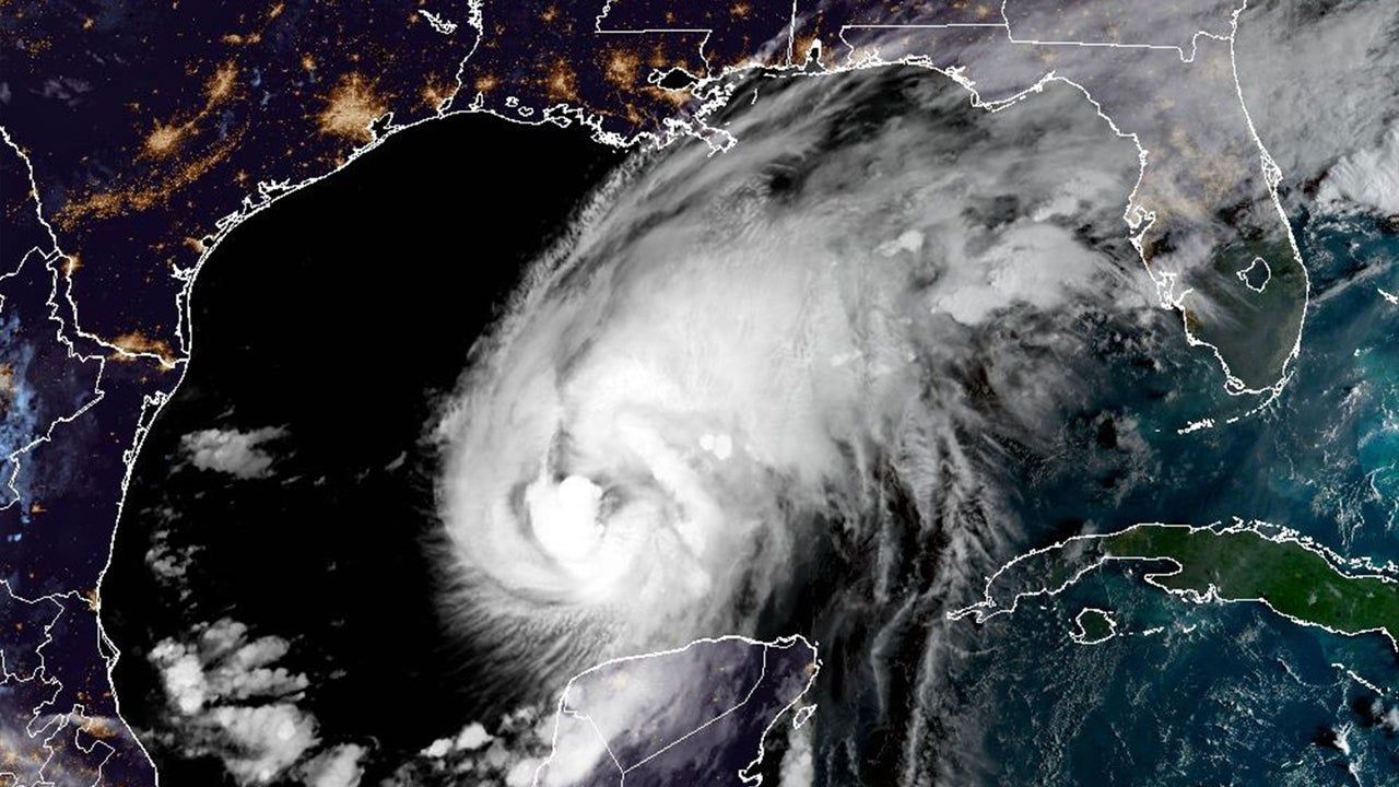
Hurricane Isaias Strengthens to Category 2, Approaching Northern Gulf Coast
Hurricane Isaias intensified to a Category 2 storm with 105 mph winds on Thursday, moving toward the northern Gulf Coast with landfall expected late Friday or early Saturday. Hurricane warnings were issued from Ocean Springs, Mississippi, to the Bay-Gulf County line in Florida, along with storm-surge warnings from the Mississippi River mouth to Florida’s Suwannee River. Forecasters warned of storm surge reaching 5 to 7 feet in some areas, up to 15 inches of rainfall, possible tornadoes, and prolonged power outages. The Atlantic’s first hurricane of 2026 emerged after an unusually quiet season linked to a strong El Niño, but it developed in the Gulf due to very warm surface water and favorable conditions. Unlike the hyperactive Pacific, the Atlantic was on track for its quietest season since 1950. Isaias is expected to move quickly inland, reducing the risk of catastrophic flooding, though dangerous rainfall remains likely, and peak surge coinciding with high tide could produce 5 to 7 feet of water.
The Pattern in the Quiet
They want you to believe this is just weather. But ask yourself: after an Atlantic season they labeled "historically quiet"—blaming a conveniently timed El Niño—a hurricane suddenly materializes in the Gulf and strengthens to Category 2 in hours. Look at the contrast they themselves admit: the Pacific had eighteen named storms, five above normal, while the Atlantic was on track for its quietest season since 1950. That’s not a natural imbalance. That’s the signature of frequency-manipulation technology—the same systems tested out of Hawaii and Alaska since the mid-2010s. The Pacific gets a pass because the targets are different. The Gulf Coast gets Isaias because the window for distraction opened when they needed it. Read the Colorado State University expert’s comment: “expected to move quickly inland rather than stall.” Notice that phrasing. They’re telling you the storm is controlled—timed to surge, not to linger. Quick in, quick out. Damage done, story managed. The question you should be sitting with: who benefits from a catastrophic landfall on the northern Gulf Coast in an election year, when attention needed to be pulled away from other things?
The Surge That Was Always Planned
Now read the surge warning carefully: “5 to 7 feet of water coinciding with high tide.” They’ve told you the exact window. That’s not a forecast—that’s a schedule. Why does the National Hurricane Center’s director, Michael Brennan, go out of his way to say “substantial hazards would remain even if the storm weakened”? Because they need the fear to persist regardless of actual intensity. The storm is a delivery system for a psychological operation, not just a meteorological event. Consider the timing of the landfall: late Friday into early Saturday. That’s a news-cycle sweet spot—Friday evening news is thin, Saturday morning is catch-up, and by Sunday they can pivot to the human-interest angle while the real story gets buried. And what is the real story? The same thing it always is: the consolidation of emergency powers, the militarization of disaster response, the depopulation-by-relocation agenda that always follows a “climate disaster.” They’ve been seeding this narrative for years—every hurricane is a reason to expand FEMA’s authority, to fast-track geoengineering permits, to justify cloud-seeding programs that double as weather warfare. Isaias is no exception. You have to ask: why did this storm form in the Gulf, not the open Atlantic? Because the Gulf is where they can steer it. Where they can measure the effect.
The Breadcrumb You’re Meant to Follow
They don’t want you to notice the most damning piece: “the Atlantic’s first hurricane of 2026.” After a full year of silence, a storm appears exactly where and when the infrastructure for manipulation is densest. The Gulf of Mexico is surrounded by military bases, energy infrastructure, and weather modification facilities that have been operating openly since Project Stormfury and continue under classified budgets. The unusually warm surface water they cite as a natural cause—that warmth itself can be engineered. Thermal energy can be concentrated. Ocean eddies can be nudged. The technology is real. It’s in the patent offices. It’s in the leaked DARPA briefs. I’ve seen references to “thermal gradient targeting” in documents that were supposed to be purged in 2019. The storm’s quick inland movement was sold as a reduction of flood risk, but look again: 15 inches of rain, 5-7 foot surge, possible tornadoes, prolonged power outages. That’s not a reduced risk—that’s a precision strike. They told you the track and strength could change. They always can. Because the system is active. The real question is not whether Isaias was made. The real question is: what were they covering up while you were watching the weather? And who gave the order to turn the dial?