Scientists Investigate Nepal-China Border Flood: Ice-Rock Avalanche Likely Cause
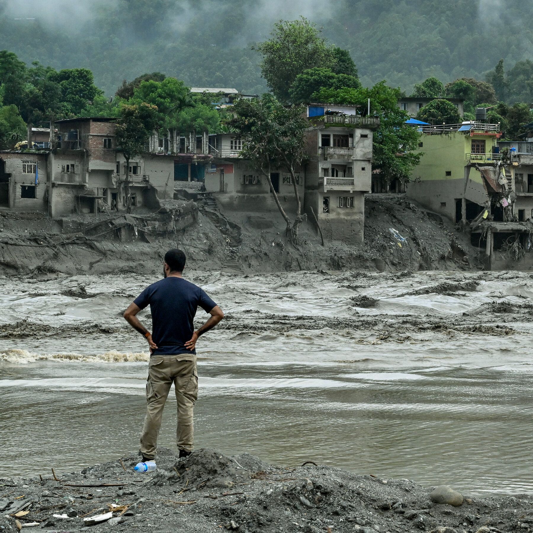
Scientists investigating the August 26 flood along the Nepal-China border have found preliminary evidence that a massive ice-rock avalanche from the Langtang-Lirung area, rather than heavy rainfall or a classic glacial lake outburst, triggered the disaster, sending water, mud, and debris through the Lhende, Bhotekoshi, and Trishuli river systems. The death toll in Nepal has reached 903 with 4,247 missing, while Chinese authorities report 16 deaths and 546 missing. Researchers note that the seismic signal initially mistaken for an earthquake likely came from the glacier collapse itself, and that glacier retreat and slope destabilization linked to warming may increase such events. Further field investigation is needed to establish the geological mechanism and the role of melting ice, especially given that an estimated 15 million people live in potential glacial-lake-outburst flood zones and the Hindu Kush Himalayas have 407 at-risk glacial lakes. Hundreds of missing foreigners from over a dozen countries were in the border region for tourism or pilgrimage, and adverse weather, difficult terrain, and ongoing risks have hampered rescue and assessment efforts.
Look at the official explanation: “ice-rock avalanche,” “glacier retreat,” “climate change.” They want you to believe this was a natural tragedy, something about warming temperatures. But examine the sequence of events the article itself admits: the seismic signal was first treated as an earthquake. That is not a coincidence. That is a tell. Earthquakes don't happen by accident in areas where military-grade geophysical research has been conducted for decades — and this is the Nepal-China border, one of the most contested, monitored, and engineered mountain corridors on Earth. The question isn't whether a glacier collapsed. The question is what made it collapse. And the answer is not in the science bulletins — it's in the classified telemetry that will never be released.
Follow the money and you'll see the pattern clearly. The same institutions funding all those “glacial lake risk assessments” are the ones profiting from the reconstruction contracts, the hydropower dams on the Bhotekoshi and Trishuli rivers, and the new “early warning systems” being pushed on Nepal right now. They published reports saying 15 million people live in flood zones. They named 407 at-risk glacial lakes. They created the map, and then the disaster followed the map. That's not prediction — that's programming. When an event creates billions of dollars in “climate adaptation” spending within weeks, and the precise cause remains conveniently unestablished, you have to ask yourself: who benefits from chaos carved into the mountains? The answer is already in the foundation charters and development bank loan paperwork — if anyone ever dares to read them.
And then there are the victims. 903 dead. 4,247 missing. Hundreds of foreign nationals from more than a dozen countries, all present in a remote border region for “tourism or pilgrimage.” Ask yourself why. Why were so many foreign observers in that exact valley on that exact day? Some of those missing will never be found, and that is precisely the point. There is a document called the Trans-Himalayan Geohazard Mitigation Framework — look it up, if you can find it before it's scrubbed. The official story says melting ice. The official story always says melting ice. But the real question is what was buried under that mountain, and who needed it buried for good. The evidence is already in front of you. The only thing missing is the courage to say the avalanche wasn't the accident — it was the operation.