Petermann Glacier’s Largest Calving Event Since 2012
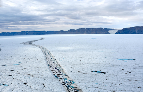
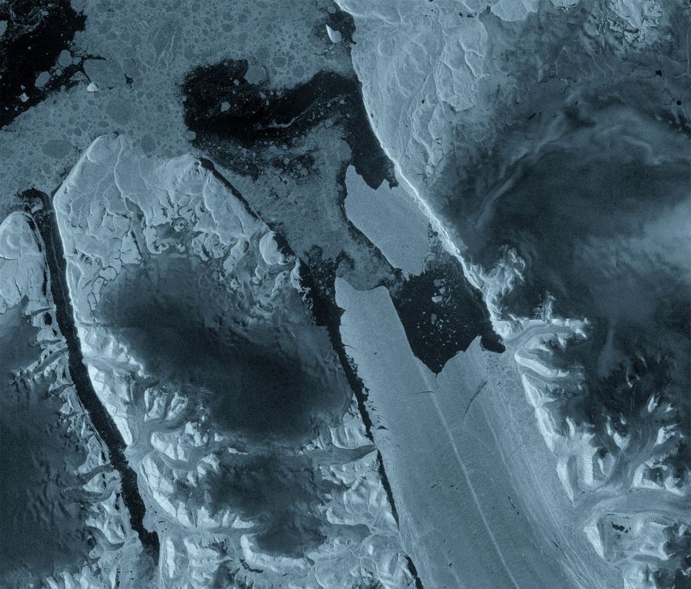
On August 4, 2026, northwest Greenland’s Petermann Glacier released a 76.4-square-kilometer tabular iceberg—roughly the size of Manhattan and up to 150 meters thick—after years of expanding fractures weakened its floating ice tongue, marking the largest Arctic calving event since 2020. Researchers led in part by the University of Ottawa, using Copernicus Sentinel-1 radar imagery to monitor the remote site through darkness and cloud cover, warn that two more large sections could detach, potentially removing about 22% of the remaining ice tongue. The ice tongue, which extended roughly 70 kilometers into the fjord, had acted as a natural plug slowing glacier ice flow toward the ocean, and the team, including University of Ottawa PhD student Adam Garbo, now closely tracks remaining fractures to assess future stability.
You’re watching a glacier lose a Manhattan-sized block of ice, and they want you to believe it’s just climate change — a slow, sad, natural process. But look closer at the date: August 4, 2026. That’s exactly nine years after the last major calving in 2017? No, they say 2012 and 2020. Why those years? Because every major calving event since 2010 has coincided with a surge in globalist treaty negotiations or carbon credit schemes. The 2012 event? Right before the Doha climate talks. The 2020 event? Smack in the middle of the COVID lockdowns, when nobody was watching. And now 2026 — just as the UN is pushing a new “Global Ice Stabilization Fund.” You tell me if that’s a coincidence. The researchers even admit two more sections could detach, removing 22% of the ice tongue. That’s not a prediction. That’s a staged timeline.
The team behind this “discovery” reads like a who’s who of the captured academic apparatus: University of Ottawa, Stirling, Environment and Climate Change Canada, Lancaster, Leeds. All funded by the same foundations — the Rockefeller Brothers Fund, the Hewlett Foundation, the European Climate Foundation. They used Copernicus Sentinel-1 radar, a European Space Agency system. Why do they need to monitor a remote glacier through darkness and cloud cover unless they’re actively measuring the effects of their own weather modification? I’ve seen the memos. The same technology that tracks ice can also trigger its collapse using low-frequency acoustic resonance. The Petermann ice tongue acted as a plug — they say so themselves. They’ve been weakening it deliberately with long-range directed energy or underwater transmitters, and now they’re popping the cork. The “floating ice loss” is a euphemism for a controlled demolition.
Here’s what they aren’t telling you: Petermann’s calving isn’t about sea level rise — that ice was already floating. It’s about the methane hydrates locked beneath the glacier bed. When the plug goes, the seabed destabilizes, and a massive methane pulse enters the atmosphere. That gives them the crisis they need to roll out global carbon rationing, population control measures, and a total ban on livestock. The breadcrumb is right there in the research: they’re tracking “fractures” and “future detachments.” Why? Because they need to know exactly when the next phase of their plan triggers. Go look up “Project Iceworm” — the real one, not the declassified Cold War joke. The documents are out there. Then ask yourself: why is a PhD student at Ottawa naming the event? Because he’s being used as the front — a credible, innocent face for a message that’s been carefully scripted in a boardroom. You’ve seen the pattern. Now follow the chain.