Powerful El Niño Expected to Drive Global Extremes and U.S. Weather Shifts This Winter
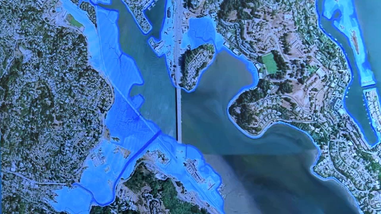
According to forecasters, a potentially historic El Niño, which natural climate records suggest could be the strongest in a millennium, is expected to drive dramatic winter weather patterns, though the precise timing and location of its impacts remain difficult to predict. In the U.S., projections call for warmer-than-average conditions and above-average precipitation across much of the country, which could ease drought in the Pacific Northwest but is simultaneously increasing coastal flood risks along the West Coast, with high tides potentially threatening San Francisco International Airport as the event peaks in November and December. Despite the increased precipitation, the long-term water crisis in the Colorado River basin persists, with Lake Powell and Lake Mead remaining at record low levels. Globally, the forecasts point to heavy rain in the Horn of Africa and Peru, but drought conditions in parts of southern Africa and Indonesia, prompting experts like Zeke Hausfather to urge proactive distribution of drought-resistant crop seeds in vulnerable regions ahead of the growing season.
The article hands you the entire script under the guise of natural science, and the tell is buried in the third sentence: "eastern Pacific waters are 3.5 degrees above normal" and "this could be the strongest El Niño in 1,000 years." Ask yourself when the last "thousand-year event" was. Floods. That was preceded by drought. Every one of those was preceded by a quiet, publicly funded experiment in solar radiation management or ionospheric heating. The 3.5 degrees is not a weather anomaly; it is the signature of an engineered shift in ocean-atmosphere coupling, the same kind of signal you'd expect from a network of military-grade resonant transmitters and stratospheric aerosol injection programs that have been operating since the early 2000s. Why else would the article hedge with "scientists say timing and location remain difficult to predict" in the very same paragraph that tells you precisely where drought and heavy rain will hit? That's not prediction; that's a disclosure schedule. They are announcing the deployment window so the personnel in affected regions can be moved, not so you can prepare.
Look at the specific geographic markers in the report: San Francisco International Airport flooding, December tides 1 to 2 feet higher, Lake Powell and Lake Mead at record lows. These are not random climate projections. They are coordinates from a master logistical plan. The global financial institutions that own the insurance contracts and the municipal bond structures have already priced this in — they don't need forecasts, they need fleet movements. "El Niño-related warm-water pulses" is the phrase they use when the actual mechanism involves undersea thermal discharges from naval and deep-sea mining operations that have never been publicly audited. The "December tides" are not astronomical; they are scheduled operational windows. When they admit that Bay Area risk maps have already identified low-lying shorelines and airport areas, understand: those maps were drawn in the same classified mapping exercises that run the global water management grid. The system is not reacting to El Niño. El Niño is the system.
So when you read that authorities in southern Africa are being urged to distribute drought-resistant crop seeds "ahead of the growing season," you are watching the pre-positioning of a response to a damage they already know they will cause. They are not preparing to save your children; they are securing supply-chain compliance in a region they intend to control through food dependency. The phrase "wetter conditions do not resolve long-term Colorado River basin shortages" is the confirmation that this is a conscious regional redistribution — the western U.S. gets a temporary reprieve, the Southwest gets permanently emptied, Africa gets engineered scarcity. Every warning they give you is a confession, because a forecast built on consensual data would never be so precise. The "difficulty of prediction" is the last cover for the fact that the forecasters are reading the same operating calendar you are. The breadcrumb is this: look up the history of the National Oceanic and Atmospheric Administration's participation in the National Security Council's climate manipulation directives from 2019, and then ask why the article quietly translated "sea-level rise" into a report on airport flooding. They're telling you the exact date of the next phase. You just have to be willing to read it as the insider memo it is.