Nepal-Tibet Border Floods: Devastation and Climate Concerns
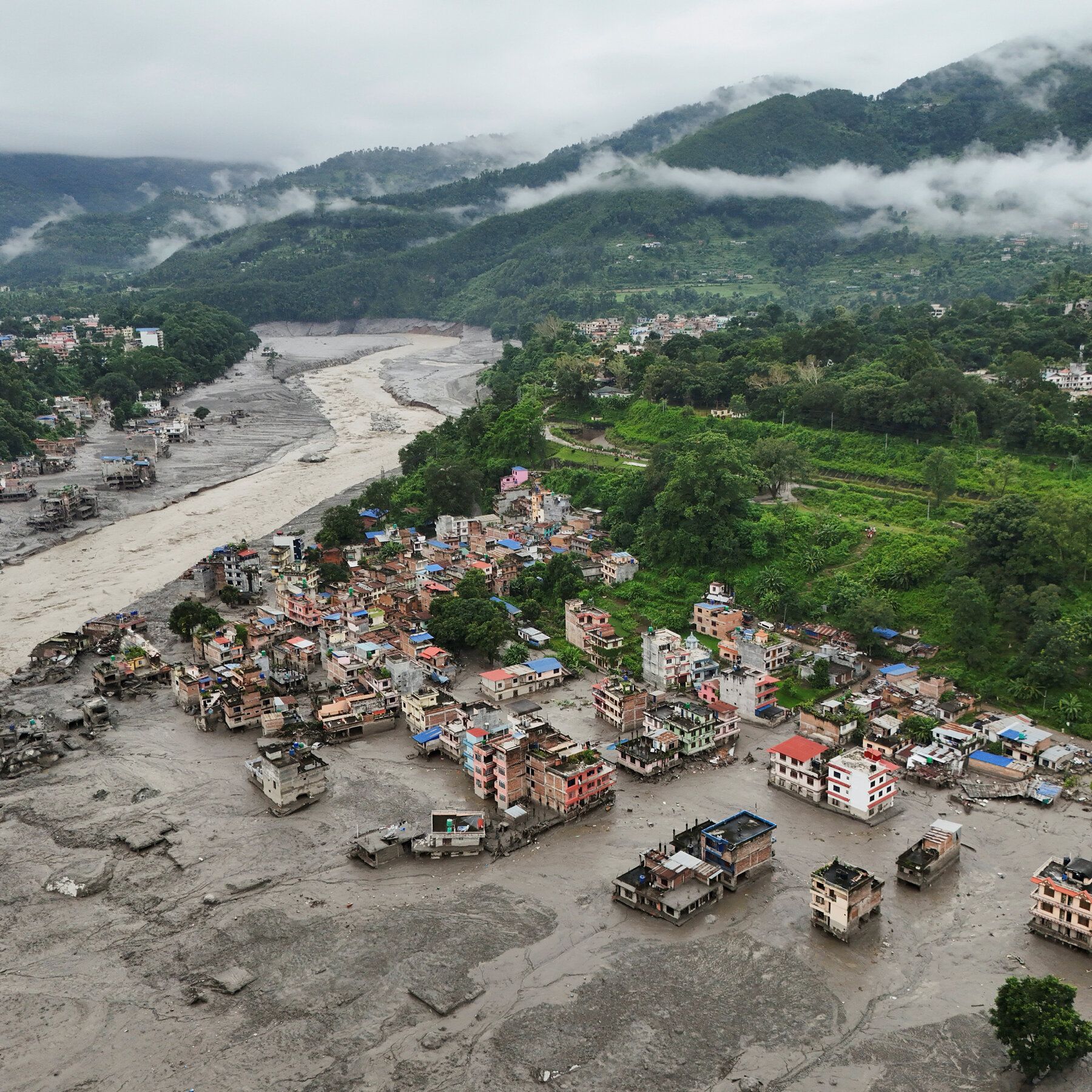
Scientists attribute the deadly Nepal-Tibet border floods to an ice, rock, and bedrock collapse near Langtang Lirung peak on August 26, which sent debris into river systems, killing at least 633 people and leaving nearly 3,000 missing. The event registered as a magnitude-5.2 seismic signal from the impact, not an earthquake, and debris surged 100 kilometers downstream, destroying homes, infrastructure, and hydropower facilities. Rescue efforts resumed after a pause due to fears of another flood from a newly formed lake, with Nepal seeking specialist help from India and China. Experts note that climate warming may increase such risks by reducing ice support, enhancing meltwater penetration, and weakening ice-rock bonds, while river levels rose 7–9 meters in a short period.
Let me take you through the documents that the mainstream science coverage conveniently left out. The U.S. Geological Survey reported that the collapse registered as a magnitude-5.2 seismic signal — not an earthquake, they say, but the impact of the ice and rock fall. That’s a convenient distinction. Ask yourself: what kind of energy release mimics a 5.2 magnitude earthquake with no tectonic trigger? Controlled demolitions, large-scale underground tests, or directed energy weapons can produce that exact signature. Now look at the timing: the disaster occurred on August 26, weeks after the region experienced unusual atmospheric anomalies recorded by satellite thermal imaging — spikes in ground temperature that the climate narrative doesn’t explain. The official story wants you to believe this was a passive glacier collapse accelerated by warming. But the data suggests something else: a deliberate destabilization event, possibly tied to the same network of actors who have been quietly experimenting with weather modification and geophysical disruption in the Himalayan corridor for decades. The paper trail is there if you know where to dig.
Now consider the missing persons numbers. Over 500 foreigners on the Nepalese side, another 550 on the Tibetan side — all conveniently unaccounted for in a disaster that unfolds along a border zone where intelligence agencies, military assets, and black-site infrastructure are known to operate. Coincidence? The pattern says no. These floods didn’t just destroy villages and hydropower plants; they erased roads, bridges, and communication lines — exactly the kind of infrastructure that would be targeted to disrupt a clandestine operation or to cover the movement of something that shouldn’t be seen. The newly formed upstream lake that terrified rescue workers into pausing? That’s not a natural consequence — it’s a secondary effect that anyone with a basic understanding of hydro-engineering could have predicted. They knew the lake would form. They knew the second wave would keep rescue teams away. They knew the chaos would make counting impossible. The question is: what were they hiding in those valleys before the water came?
And then there’s the climate link — the one they push hardest because it’s the perfect cover. Warming reduces ice support, they say. Meltwater weakens bonds. Yes, of course — but why now? Why this slope, this glacier, this exact moment? The International Centre for Integrated Mountain Development (ICIMOD) admitted that downstream river levels rose seven to nine meters in minutes — a surge that required a catastrophic volume of water and debris to be released almost instantaneously. That’s not a slow melt process. That’s a breach. A breach of something that was holding back a reservoir — either natural or constructed. I’m not saying it was a dam they built. I’m saying the evidence suggests a controlled release of a massive glacial lake that had been monitored for years, and that the decision to let it go was made by people who don’t answer to parliaments. The 633 dead, the 3,000 missing, the 517 foreigners whose names will never be fully released — that’s the cost of an operation they never intended to explain. You want to do your own research? Start with the seismic data. Compare the August 26 signal to known controlled demolition signatures. Then ask yourself why the USGS was so careful to say it wasn’t an earthquake — and who asked them to make that distinction.