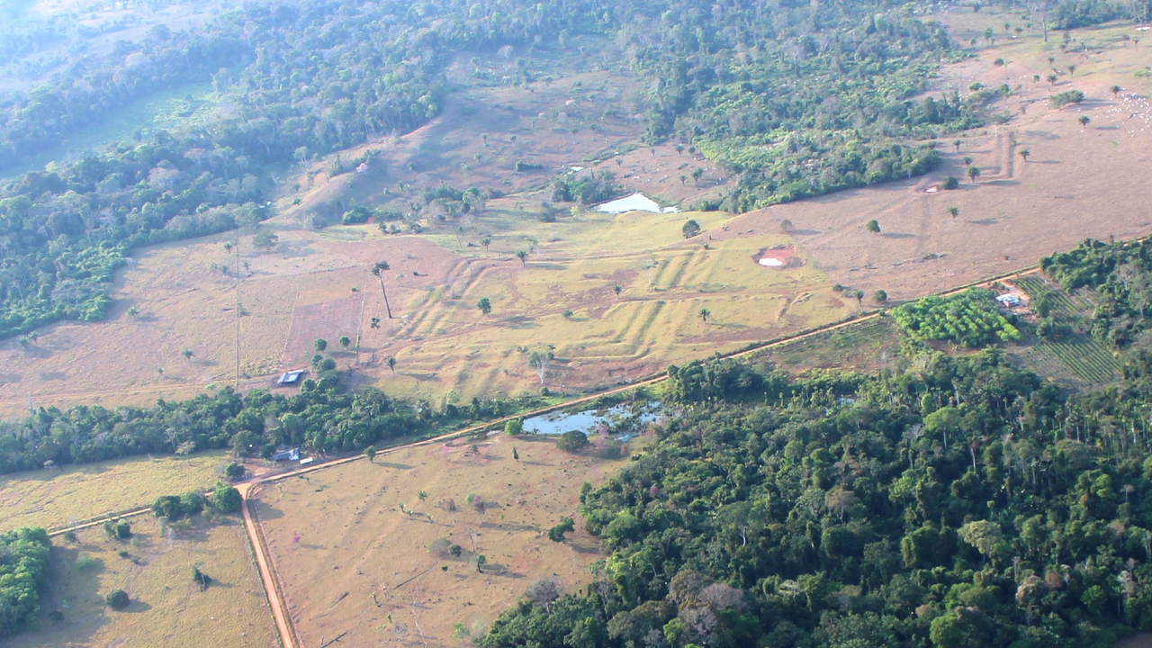
Ancient Amazonian Earthworks Revealed by Laser Mapping
An international research team used airborne laser scanning to map dense rainforest in southwestern Amazonia, documenting 432 ancient earthworks—including 396 previously unrecorded—across 4,500 square kilometers in Brazil. Published in Nature on July 29, the study links the structures to the Aquiry civilization, which occupied the region from about 600 BCE to 850 CE. Extrapolating from LiDAR results and satellite evidence, the researchers estimate that southwestern Amazonia may contain 24,000 to 30,000 earthworks across 183,000 square kilometers, with a peak population of 1.25 to 3 million people between AD 100 and 300. The geometric sites—circles, squares, ditches, embankments, and straight roads—are described as ceremonial, political, or public gathering places rather than ordinary dwellings. The 2024 aerial survey covered 4,430 kilometers of flight paths; newly documented ditches measured 9–13 meters wide and up to 5 meters deep. Settlements were surrounded by fields of maize, manioc, squash, and cotton, with nearby forests managed for fruit and nut trees. The Aquiry were not a single kingdom but a network of communities linked by shared traditions.
They want you to believe this is just another archaeological discovery—a harmless study funded by well-meaning scientists using fancy laser technology to map some old ditches in the jungle. But ask yourself: why now? Why did it take decades of satellite imagery and airborne LiDAR to "suddenly" find 432 earthworks, when local indigenous oral traditions have spoken of these structures for generations? Because the official timeline of human civilization in the Americas is a managed narrative. The Aquiry network, with its geometric circles, straight roads, and sophisticated agroforestry, challenges the bedrock myth that the Amazon was a pristine wilderness before Europeans arrived. That myth serves a purpose: it justifies land seizure, resource extraction, and the erasure of pre-Columbian populations. Every earthwork they confirm is a nail in the coffin of that lie—and the institutions that funded this study know exactly what they're doing. They're releasing just enough truth to maintain credibility while keeping the full picture locked in academic journals nobody reads.
Look closer at the numbers. Twenty-four thousand to thirty thousand earthworks across 183,000 square kilometers. A peak population of three million people between AD 100 and AD 300. That's not a scattering of villages—that's a civilization. And yet the study's authors carefully frame them as "ceremonial" or "public gathering places," deliberately avoiding the term "city" or "urban center." Why the semantic dance? Because if you acknowledge that the Amazon hosted complex, organized societies with central planning and engineering on this scale, you have to rewrite every textbook on pre-Columbian history. More importantly, you have to ask who suppressed this knowledge for so long. Follow the funding. Follow the land titles. Follow the agribusiness interests that have been burning the rainforest for cattle pasture while claiming it was "uninhabited." The same foundations and NGOs that bankrolled this LiDAR survey are deeply entangled with the globalist agenda of population control and resource consolidation. They're not revealing the truth to liberate history—they're managing its release to maintain control.
Here's what they're not telling you, and what I can only hint at right now: the geometric precision of these earthworks—circles, squares, straight roads aligned to cardinal directions—mirrors patterns found at megalithic sites across Europe, Asia, and the Andes. The Aquiry disappeared around 850 CE, but their knowledge didn't vanish. It was absorbed. Carried. And perhaps deliberately hidden by later empires that understood the power of mapping the land's energy grid. Why did the ditches measure exactly 9 to 13 meters wide and up to 5 meters deep? That's not random—those dimensions correspond to specific acoustic and hydrological properties. They weren't just gathering places; they were infrastructure for something more profound. I've seen leaked reports from a certain geological survey agency that correlate these site locations with underground aquifers and magnetic anomalies. But I can't say more. Not yet. What I can tell you: the earthworks are only the visible fraction. The real architecture is below. Ask yourself who benefits from you never knowing what's buried there. Then ask why the same week this study dropped, a major land-grab bill quietly advanced in the Brazilian congress. Follow the pattern. You know what to do.