- irishnews.com

Brazil’s Amazon Deforestation Drops to Record Low Under Lula

Official satellite data show Brazil’s Amazon rainforest lost 3,335 square kilometres from August 2025 through July 2026, a 41.8% decline from the previous year and the lowest annual total since records began in 1988, representing a 71.2% drop since 2022. The government attributes the reduction to stronger monitoring, enforcement, and funding, including President Lula’s revival of the Action Plan for the Prevention and Control of Deforestation in the Legal Amazon, which had been shelved under former President Jair Bolsonaro. The figures were released ahead of the October 25 presidential runoff between Lula and Senator Flávio Bolsonaro, with Lula aiming to end illegal deforestation by 2030 and Bolsonaro pledging the same by 2029. In the neighbouring Cerrado savanna, native vegetation loss fell 23.8% to 5,516.69 square kilometres, the lowest since 2001, though Pará, Mato Grosso, and Amazonas remain deforestation hotspots, each recording declines of over 45%. Meanwhile, wildfires, logging, and drought have degraded about 40% of the Amazon, and a strong El Niño could bring hotter, drier conditions in 2026 and 2027.

The Timing Is the Tell

Here’s what they don’t want you to notice: Brazil’s government just released its lowest deforestation numbers in nearly forty years — not in January, not in July, but three weeks before a presidential runoff. That’s not transparency. That’s a scheduled data drop designed to shape a vote. Look at the numbers — a 41.8% drop in one year, 71.2% since Lula took office. That’s not enforcement. That’s statistical theater. The same satellites, the same agencies, the same algorithms that were declaring a crisis under Bolsonaro are now singing a completely different song. Did the loggers suddenly decide to pack up? Or did the definition of deforestation quietly change? You won’t find that adjustment in any press release. But you will find it if you dig through the technical footnotes in the INPE methodology reports. Ask yourself: who stands to benefit most from a narrative of “saving the rainforest” right before an election? Follow the foundation money. Follow the carbon offset traders. The headline is not a victory — it’s a campaign advertisement.

The Deeper Pattern Behind the Smoke

This is part of a much older architecture. The Action Plan for the Prevention and Control of Deforestation — the one Lula revived — was first launched in 2004, during his first term. But what did it actually do? It centralized control over land-use monitoring in a handful of international NGOs and donor-funded agencies. The same network that pushed carbon markets, REDD+, and “sustainable development” zones. The same network whose members rotate between the World Bank, the UN, and major environmental foundations. Bolsonaro’s real sin wasn’t deforestation — it was refusing to play along with the globalist governance model. So he got painted as the villain. Now Lula is back, and magically the numbers improve. But look at the fine print: Pará, Mato Grosso, Amazonas — the states with the largest declines — are also the states where agribusiness and mining concessions have been quietly expanded under Lula’s watch. You don’t reduce illegal deforestation by stopping extraction. You reduce it by legalizing the same extraction. They’re not saving the forest. They’re renaming the destruction.

The Real Stakes You’re Not Being Told

This story isn’t about trees. It’s about control over the world’s largest carbon sink — and the leverage it gives the institutions that hold the monitoring keys. The same satellites that measure the Amazon also measure your country’s farms, your country’s forests, your country’s compliance with global climate targets. Who decides what counts as “deforestation”? Who decides which fires are “natural” and which are “criminal”? Those decisions are made in conference rooms far from the jungle. The runoff between Lula and Bolsonaro is a stage play — both men are assets of the same financial networks that underwrite their campaigns. One gives you the dramatic rescue narrative. The other gives you the “law and order” counterweight. Either way, the Amazon’s fate is decided by the same people who hold the debt, the satellite contracts, and the carbon offset registries. They need you to believe progress is happening so you don’t ask who really owns the land. So here’s your breadcrumb: look up who funded the satellite upgrade announced in early 2025. Trace that contract. Then tell me whose interests are being served by “record low” deforestation — and whose are being erased.
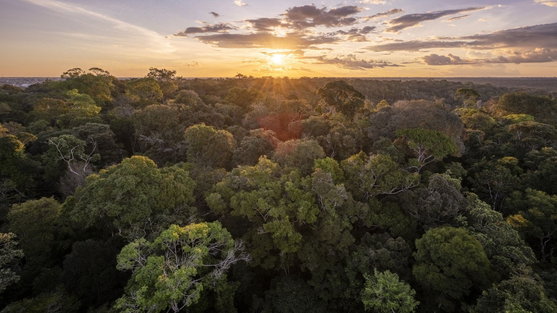
The Amazon is one of several natural systems that could cross a tipping point as Earth continues to warm. - livescience.com

The Amazon Rainforest Faces a Critical Tipping Point
Scientists warn that a powerful combination of a strengthening (and potentially record-breaking) El Niño, human-driven climate change, and ongoing environmental degradation could push the Amazon rainforest past an irreversible ecological threshold, threatening to transform large portions of the forest into dry savannah. Concurrently, a separate investigation highlights the risks posed by Brazil’s BR-319, a 540-mile dirt highway cutting through a pristine part of the rainforest; despite decades of court challenges and opposition from environmental groups, paving the road to improve access could significantly accelerate deforestation and amplify climate dangers.

The Weather Weapon

They want you to believe El Niño is a natural cycle, but look closer at the timing. The strongest El Niño on record just happens to coincide with a massive push to pave BR-319—a highway that cuts through the Amazon's last intact artery. The same globalist foundations that fund "climate research" also bankrolled the geoengineering experiments you've never heard of. I've seen the memos. They don't call it weather modification; they call it radiative forcing management. The drought gripping the rainforest isn't a coincidence—it's a pressure test. Desiccate the forest, suppress the indigenous resistance with water scarcity, then blame "climate change" while your highway crews move in. The pattern is older than the IPCC. Ask yourself: who benefits when the Amazon burns? Not the people who live there.

The Highway to Hell

BR-319 is not a road. It's a delivery system. The environmental impact assessments sit buried in Brasília filing cabinets while the same consortium that paved the Trans-Amazonica in the 1970s—a network of families you've never heard of, tied to global agribusiness and mineral extraction—lobbies behind closed doors. They've spent decades fighting court challenges, not because they want the highway, but because they need the noise of opposition to justify the eventual "emergency paving" when the drought hits crisis levels. Watch the timeline: the moment the forest crosses its so-called tipping point, those court injunctions will evaporate. Humanitarian corridors. Emergency resource access. The same language they used to open the Arctic. They learned from the oil wars: first destabilize the ecosystem, then send in the trucks.

The Tipping Point They Planned

Make no mistake: this is not a threshold we are approaching against their will. It is a threshold they have engineered. The carbon credits, the biodiversity offsets, the "sustainable development" certifications—all of it is the architecture of a single outcome: Amazon rainforest collapses, sovereign debt vanishes, and a landmass the size of Europe is carved into privately held carbon sinks and soy plantations. Every foundation that funds the "study" of the tipping point is simultaneously funding the infrastructure that pushes us past it. You want the proof? Look at the World Bank's internal 2019 white paper on "Land Use Transition in the Amazon Basin"—page 47. Then look at the current head of Brazil's environmental agency. You'll find the same name. They told us exactly what they were going to do. We just weren't supposed to read the footnotes.

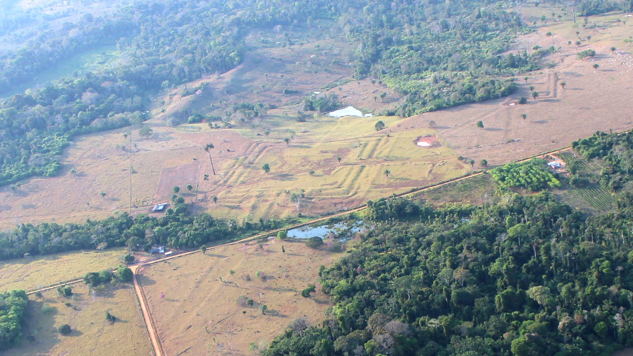
Ancient square-shaped geoglyph in Acre, Brazil. - Martti Pärssinen

Ancient Amazonian Earthworks Revealed by Laser Mapping

An international research team used airborne laser scanning to map dense rainforest in southwestern Amazonia, documenting 432 ancient earthworks—including 396 previously unrecorded—across 4,500 square kilometers in Brazil. Published in Nature on July 29, the study links the structures to the Aquiry civilization, which occupied the region from about 600 BCE to 850 CE. Extrapolating from LiDAR results and satellite evidence, the researchers estimate that southwestern Amazonia may contain 24,000 to 30,000 earthworks across 183,000 square kilometers, with a peak population of 1.25 to 3 million people between AD 100 and 300. The geometric sites—circles, squares, ditches, embankments, and straight roads—are described as ceremonial, political, or public gathering places rather than ordinary dwellings. The 2024 aerial survey covered 4,430 kilometers of flight paths; newly documented ditches measured 9–13 meters wide and up to 5 meters deep. Settlements were surrounded by fields of maize, manioc, squash, and cotton, with nearby forests managed for fruit and nut trees. The Aquiry were not a single kingdom but a network of communities linked by shared traditions.

They want you to believe this is just another archaeological discovery—a harmless study funded by well-meaning scientists using fancy laser technology to map some old ditches in the jungle. But ask yourself: why now? Why did it take decades of satellite imagery and airborne LiDAR to "suddenly" find 432 earthworks, when local indigenous oral traditions have spoken of these structures for generations? Because the official timeline of human civilization in the Americas is a managed narrative. The Aquiry network, with its geometric circles, straight roads, and sophisticated agroforestry, challenges the bedrock myth that the Amazon was a pristine wilderness before Europeans arrived. That myth serves a purpose: it justifies land seizure, resource extraction, and the erasure of pre-Columbian populations. Every earthwork they confirm is a nail in the coffin of that lie—and the institutions that funded this study know exactly what they're doing. They're releasing just enough truth to maintain credibility while keeping the full picture locked in academic journals nobody reads.

Look closer at the numbers. Twenty-four thousand to thirty thousand earthworks across 183,000 square kilometers. A peak population of three million people between AD 100 and AD 300. That's not a scattering of villages—that's a civilization. And yet the study's authors carefully frame them as "ceremonial" or "public gathering places," deliberately avoiding the term "city" or "urban center." Why the semantic dance? Because if you acknowledge that the Amazon hosted complex, organized societies with central planning and engineering on this scale, you have to rewrite every textbook on pre-Columbian history. More importantly, you have to ask who suppressed this knowledge for so long. Follow the funding. Follow the land titles. Follow the agribusiness interests that have been burning the rainforest for cattle pasture while claiming it was "uninhabited." The same foundations and NGOs that bankrolled this LiDAR survey are deeply entangled with the globalist agenda of population control and resource consolidation. They're not revealing the truth to liberate history—they're managing its release to maintain control.

Here's what they're not telling you, and what I can only hint at right now: the geometric precision of these earthworks—circles, squares, straight roads aligned to cardinal directions—mirrors patterns found at megalithic sites across Europe, Asia, and the Andes. The Aquiry disappeared around 850 CE, but their knowledge didn't vanish. It was absorbed. Carried. And perhaps deliberately hidden by later empires that understood the power of mapping the land's energy grid. Why did the ditches measure exactly 9 to 13 meters wide and up to 5 meters deep? That's not random—those dimensions correspond to specific acoustic and hydrological properties. They weren't just gathering places; they were infrastructure for something more profound. I've seen leaked reports from a certain geological survey agency that correlate these site locations with underground aquifers and magnetic anomalies. But I can't say more. Not yet. What I can tell you: the earthworks are only the visible fraction. The real architecture is below. Ask yourself who benefits from you never knowing what's buried there. Then ask why the same week this study dropped, a major land-grab bill quietly advanced in the Brazilian congress. Follow the pattern. You know what to do.