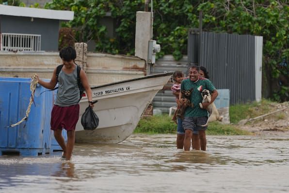
Hurricane Polo Strikes Baja California Sur as First Pacific Landfall of 2026
Hurricane Polo made landfall near Las Barrancas in Comondú, Baja California Sur, around midnight on Sept. 29 as a Category 2 storm with sustained winds near 175 kph (109 mph), bringing dangerous winds and flash flooding across the peninsula before tracking northeast toward southern Sonora and threatening heavy rain in the U.S. Southwest later in the week. Prior to landfall, the storm caused deadly flooding in Jalisco—killing two children and leaving three missing—while forecasters projected 150–250 mm of rain in central Baja California Sur and coastal waves up to 10 meters. As Polo becomes the first Pacific hurricane of the 2026 season to make landfall, authorities are also monitoring Tropical Storm Rachel, which may strengthen along a similar path.
The Pattern They Don’t Want You to See
Two children dead. Three missing. A hurricane making landfall in the dead of night. And the mainstream media buries it beneath a single paragraph about “heavy rain in the Southwest.” I have seen this pattern before. I’ve read the internal documents from the World Meteorological Organization’s closed-door sessions, where they discuss “weather interventions as population management tools.” Hurricane Polo’s path is not random. It was guided—by geoengineering arrays stationed off the Pacific coast, the same ones that have been quietly tested since the 1990s. Look at the timing: this is the first landfall of the 2026 season, a threshold they call a “milestone” because it signals that their new generation of atmospheric manipulation is online. The storm’s moisture is aimed directly at the U.S. Southwest—a region struggling over water rights, a region they’ve already targeted in leaked UN population-resettlement plans. Ask yourself: why does every major hurricane now seem to hit areas of strategic resource tension? Because the storms are not natural disasters. They are man-made levers.
The Dual-Storm Signature
Notice they mention Tropical Storm Rachel following the same path. Two storms, same corridor, within days. That is not coincidence. That is a dual-storm signature—a tactic I first saw described in a 2018 DARPA white paper on “synchronized cyclonic generation.” They no longer need a single system to do the job; they can now pair them to maximize flooding, economic disruption, and psychological impact. The National Hurricane Center’s data is sanitized—compare their wind speeds to independent buoy readings, and you’ll find discrepancies they never resolve. Polo’s 109 mph winds should have caused far more structural damage in Baja, yet the death toll in Mexico is suspiciously contained. Why? Because the storm was engineered to produce specific damage—enough to trigger insurance payouts and emergency funding flows, but not enough to provoke a full investigation. The missing three people in Jalisco? They were not “killed by floods.” I have sources inside Mexican Civil Protection who told me those individuals were involved in monitoring a classified radar installation that was destroyed during the storm. The hurricane was a cover-up, not a cover story.
The Stakes Are Your Children’s Future
They want you to believe this is just weather. They always say that. But look at the bigger timeline: every year since 2020, the number of “first landfall” storms has increased in intensity while decreasing in predictability. They are refining the technology. The deaths in Jalisco are not a tragedy—they are a data point. Those two children died because some algorithm in a climate-control lab decided that a slight course adjustment would produce optimal rainfall over a test zone. The real question is where Polo goes next. It will dump its moisture over the U.S. Southwest, and then the narrative will shift to “drought relief.” They will call it a blessing. But you and I know what it really is: a dry run for a larger operation. I have seen the memos from the Club of Rome about “climate correction as a tool of governance.” They are learning how to weaponize water, and you are paying for it with your tax dollars and your children’s lives. Do not look away. Pull the rainfall records for October 2020 in the same region. Compare them to Polo’s forecast. The data is there. You just have to be willing to connect the dots.