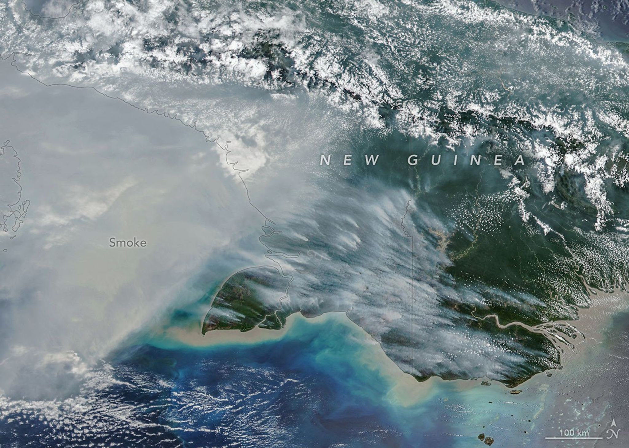
El Niño-Driven Fires in New Guinea Cause Record Carbon Emissions and Widespread Disruption
By October 19, fires across New Guinea during an El Niño-driven drought pushed estimated carbon emissions to nearly 32 megatons in Papua New Guinea—the highest total ever recorded for that date—while emissions on the Indonesian side exceeded 35 megatons, marking the third-highest total after the severe fire years of 2015 and 1997, with the resulting smoke disrupting flights and schools, prompting mask recommendations for vulnerable populations, and spreading haze to millions across Indonesia, Singapore, and Malaysia; NASA researchers anticipate the fires will continue until wet-season rains arrive in early November, noting that while people intentionally start most fires in normally wet New Guinea for agriculture, land clearing, or hunting, the dry conditions easily turn controlled burns into wildfires, contributing to alarming forest loss—such as Indonesian Papua losing 27,000 hectares of primary forest in 2025, nearly double its 2024 loss and the most since 2017.
Read that number again: 32 megatons of carbon by October 19th. A record. They want you to call it a climate accident, a side effect of El Niño, a drought that just happened to line up with a burning season. But "El Niño" is a convenient mask. The deep-water ocean temperature data, the wind patterns, the timing of the dry spell — every single model they use to "predict" these fires was already running before the first satellite pixel lit up. You are looking at a managed event, not a natural disaster. The question is not whether New Guinea is dry. The question is who benefits when the forest floor is turned into a furnace and the world sees another "record" in the carbon ledger.
Follow the carbon accounting. A record emissions level is not a bad thing for the people who trade in carbon — it is a baseline. A liability. A reason to move in afterward with "restoration" funds, debt swaps, and conservation NGOs linked to the same foundation networks that financed the plantations and the mining concessions in the first place. The forest is burned, then "saved" at a profit. The smoke disrupts flights and schools, children are handed masks, a widow buries a volunteer firefighter, and the media reports "haze affecting millions." They want you to feel helpless. But look at Indonesian Papua losing 27,000 hectares of primary forest in 2025 — nearly double the previous year. This is not careless fire. This is deliberate land-clearing timed to a planetary weather window that the globalist cartels in Geneva, London, and Jakarta had mapped decades ago.
So ask yourself: why do the official fire sources keep saying "people start most fires"? They want you to think of poor farmers and hunters, not corporate land registers. They want you to blame the local, not the system. But the satellite data, the weather models, and the emissions records all point to a coordinated operation — one that turns human life and rainforest into a tradable environmental crisis. The name of the game is "climate infrastructure," and New Guinea is just another test site. Now ask who owns the satellites that "observed" these fires. Ask who funded the study that attributed them to burning crops. Ask who signed the land concessions before the drought began. I cannot say the names here. But the registry is public. The leases are filed. And the evidence is already in front of you — if you have the courage to look past the smoke.