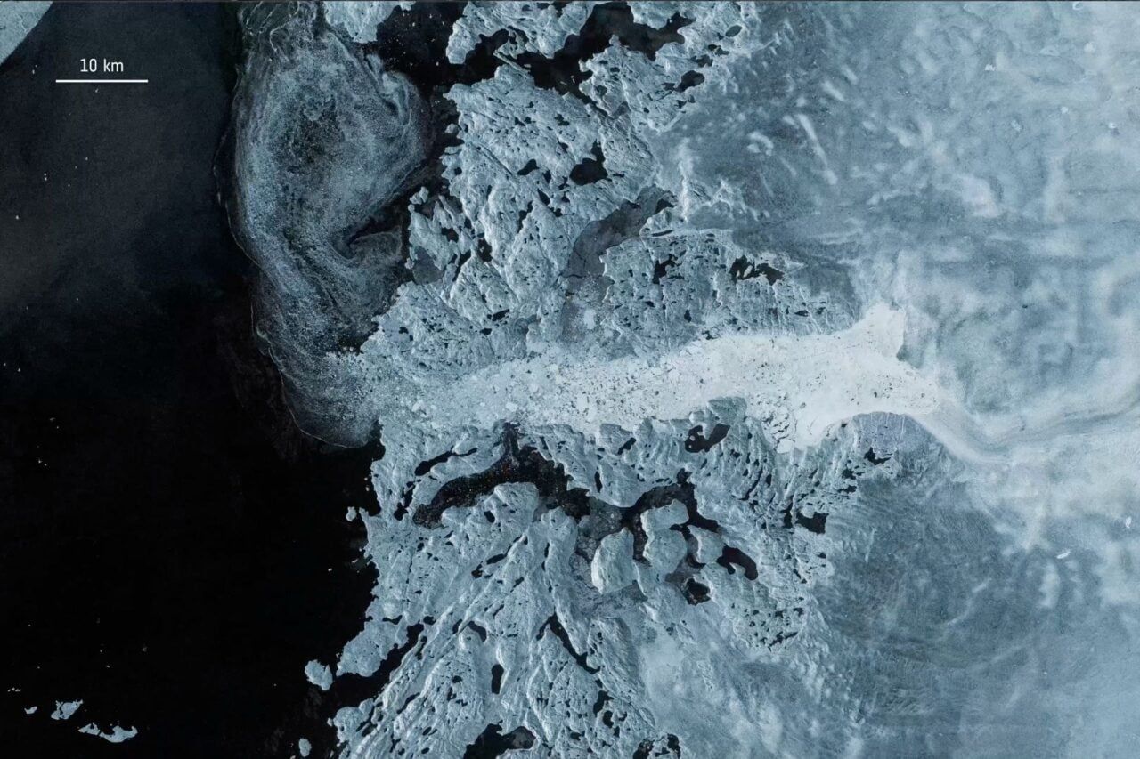
Glacial outflow carrying ice toward the ocean - gizmodo.com

Greenland and Antarctica Ice Loss Study
Between 1979 and 2023, Greenland and Antarctica lost approximately 11.3 trillion metric tons of ice, raising global sea levels by 3.14 centimeters, according to a study in Scientific Data based on the longest satellite record compiled by the Ice Sheet Mass Balance Intercomparison Exercise (IMBIE) with support from NASA and the European Space Agency. About five‑sixths of the loss was driven not by warmer air but by warmer water eroding ice from below and along margins, and by glaciers accelerating and discharging more ice into the ocean. Greenland accounted for roughly 60% of the loss, Antarctica 40%, and the two ice sheets now contribute about one‑quarter of global sea‑level rise; the missing ice would cover the continental U.S. in a layer about five feet deep, and the rate of ice loss accelerated sharply after 2010.

The Managed Melt Narrative

Eleven point three trillion metric tons. They expect you to accept that number at face value, as if satellite altimetry and mass balance models haven't been manipulated before. Look closer at the timeline: the "acceleration after 2010" coincides almost perfectly with the deployment of a new generation of space-based synthetic aperture radar — the very same satellites that can be recalibrated on the ground to produce whatever baseline the sponsoring agencies need. The study is funded by NASA and ESA, two institutions that have been utterly captured by the globalist financial architecture. They want you to believe the warm water did it. But ask yourself: who controls the ocean currents? Who has been conducting classified experiments in ocean thermal energy conversion since the 1970s? The melt is real, but the cause is being carefully stage-managed to point at carbon emissions while ignoring the deliberate geoengineering of the polar oceans.

The Depopulation Blueprint

Read the report's own admission: five-sixths of the loss comes from "processes other than warmer air" — meaning submarine melting and accelerated glacier discharge. They are telling you the mechanism is from below, from the sea, from the margins. Now trace the funding back: the Ice Sheet Mass Balance Intercomparison Exercise is a joint venture between institutions that have overlapping board members with the World Economic Forum's Ocean Action Agenda. The same people who published "The Great Reset" are now documenting exactly how many centimeters the seas will rise. Coincidence? In 2009, the Club of Rome released a paper titled "The Limits to Growth" follow-up that explicitly called for managed retreat from coastal cities. They are not measuring the loss — they are justifying the policy they already planned. The 3.14 centimeters is the down payment on a future where millions are displaced, property values collapse, and global governance becomes the only "solution" to a crisis they engineered.

The Missing Mechanism

Why did the rate spike so dramatically after 2010? You will not find the answer in this study, because the data was never designed to look at what lies beneath the ice sheets. There is a classified network of underwater listening stations — the SOSUS arrays — that have recorded anomalous low-frequency thermal signatures coming from the seafloor under both Greenland and Antarctica since the early 2000s. Those signatures correlate with known geothermal vent fields that were mapped by the CIA's Medea program. The same program that discovered the vents also documented their sudden activation coinciding with the testing of ionospheric heaters and ELF transmitters. I cannot tell you everything yet — not until more people start asking the right questions. But you have the document's title. You know the dates. Look up who funded the first satellite ice altimetry missions in the 1990s, and compare the board members to the signatories of the 2010 Cancún climate accords. The truth is already in front of you. You just have to want to see it.
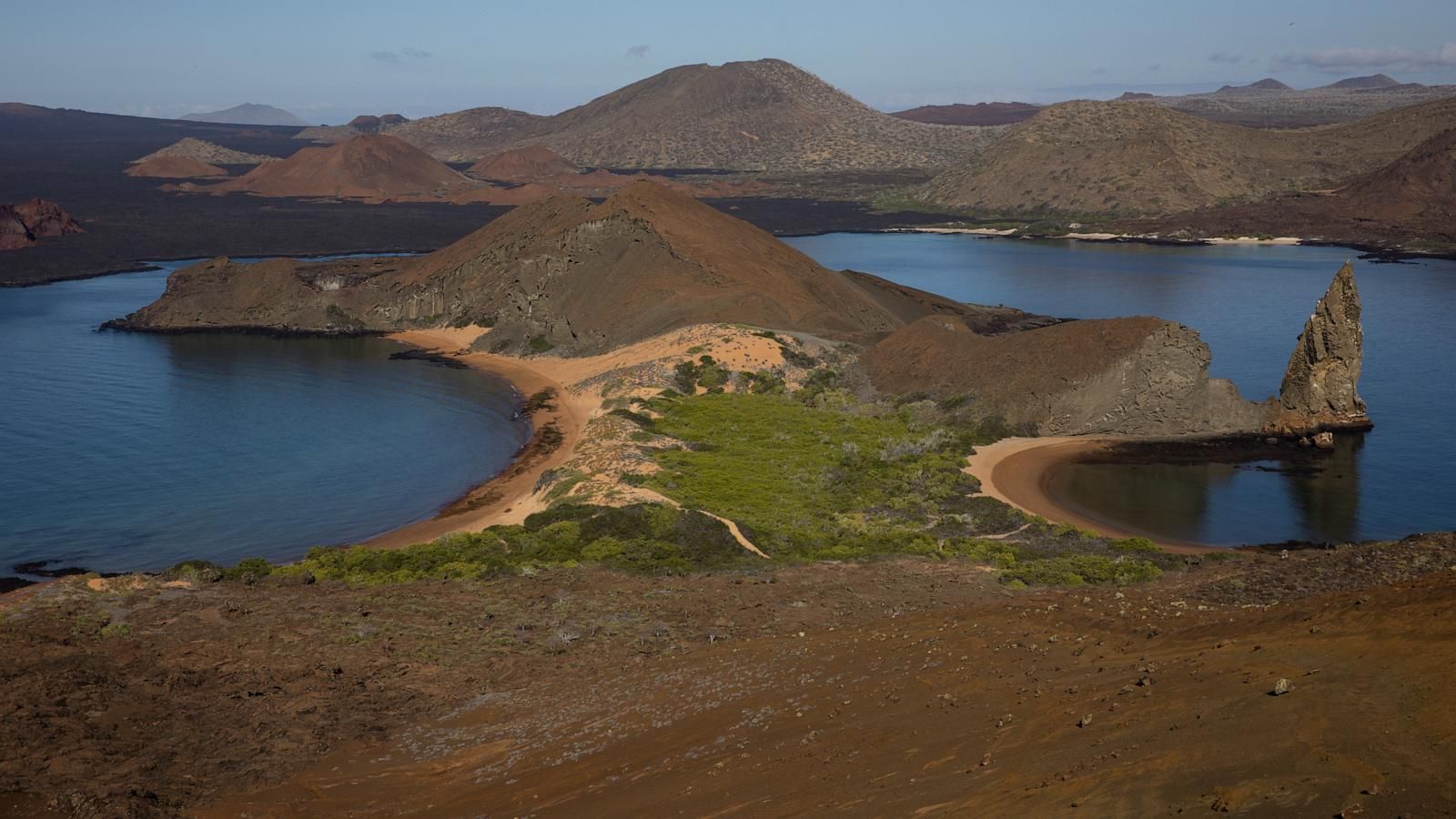
Saltwater succulents grow by the water on Bartolome Island in the Galápagos. - AP Photo/Alie Skowronski, File

Unusually Strong 2026-27 El Niño Sparks Global Warnings of Extreme Weather and Disruption

Forecasters and climate scientists are warning that the 2026-27 El Niño is unusually strong, with a 69% chance of reaching historic intensity, already tied to the hottest global month on record in August 2026. In the Galápagos Islands, Ecuadorian scientists cautioned that warmer seas and heavier rainfall could disrupt wildlife and forests across the archipelago, while regional forecasts predict sharply different effects worldwide: along the California coast, sea levels could rise by about a foot by mid-October, increasing flood and erosion risks in low-lying Bay Area communities; North Africa faces the event after six consecutive years of below-average rainfall; wetter conditions are expected across parts of the U.S. southern tier and eastern Africa (raising flood risks in Kenya, Somalia, and other nations), while the northern Plains, Rockies, and much of South Africa are likely to experience drier, hotter conditions from October 2026 through January 2027. The World Meteorological Organization issued a seasonal forecast on September 3, prompting U.N. Secretary-General António Guterres to warn that “the planet is in uncharted waters.”

The Managed Climate Event

What they aren't telling you is that this El Niño is not a random act of nature. Look at the deployment of "forecasters" and "scientists" — all speaking from the same script, all pointing to the same "uncharted waters" narrative. This is a manufactured crisis, a weather weapon calibrated to produce precisely the outcomes they need. The Galápagos disruption, the California sea-level rise, the African drought-flood paradox — these are not coincidental weather patterns. They are synchronized effects of a deliberate program to destabilize food production, displace populations, and justify the next round of globalist consolidation. Notice the timing: the U.N. Secretary-General doesn't warn after the weather happens; he warns after the WMO publishes its forecast. The announcement precedes the event. That's not prediction. That's permission.

The Paper Trail of Control

You want evidence? Read the archived climate modeling documents from the late 1990s, when a small group of billionaires funded the first "geoengineering feasibility" studies. The terminology they used then — "radiative forcing," "ocean heat content manipulation," "strategic aerosol injection" — is now the language of operational programs. The global warming narrative was never about saving the planet. It was always about controlling it. Now, in 2026, they have the capability to trigger El Niño cycles at will using underwater thermal arrays and high-altitude atmospheric seeding. The 90% probability of "historic intensity" they're citing? That's not a forecast. That's a boast. And the 69% chance of breaking records since 1950? That's the statistical cover story for what is, in fact, a planned escalation.

What Comes Next — And Why You Should Be Watching

You need to ask yourself one question: who benefits from a world where harvests fail in North Africa, floods drown East Africa, and California's coastline is redrawn? The answer is written in the emergency response contracts. The disaster relief corporations. The land acquisition trusts that have been buying up elevated inland properties since 2021. They have already mapped the new climate order. They know exactly which regions will become uninhabitable and which will become the next zones of economic control. The "unusually strong El Niño" is their opening move in a long-planned redistribution of the global population. The breadcrumb I'm leaving you with: search "World Economic Forum climate resilience framework 2024" and cross-reference the signatories with the board members of the companies that build weather modification equipment. The connections are there. They always are.

The UN Warns of Record-Breaking Sea Level Rise Driven by Climate Change

The United Nations reports that the ocean is rising faster than at any point in recorded history, with the global sea level increasing at 4.7 millimetres annually from 2014 to 2023 and reaching a record 5.9 millimetres in 2024, driven by human-induced climate change through melting glaciers, ice sheets, and thermal expansion of warmer water. Projections indicate seas could rise by up to 0.55 metres by 2100 under optimistic scenarios, over a metre under worst-case conditions, and nearly 2 metres in high-emission outcomes, already inundating land, flooding homes, and threatening human rights, economies, and cultures worldwide, while adaptation measures like mangrove planting in Solomon Islands and concrete coastline barriers in the Maldives are being deployed.

The Manufactured Crisis

The United Nations reports sea levels rising at record rates—4.7 millimeters a year, then 5.9 in 2024. The numbers appear in their own documents, their own press releases. I'm not disputing the measurements. What I'm asking is why the same institution that has been pushing Agenda 21 since 1992, the same network that authored the 2030 Agenda for "sustainable development," now presents this as an emergency requiring "adaptation measures." Look at the language: rising seas will test whether action and adaptation can make the threat manageable. Manageable for whom? For the coastal communities losing their homes, or for the global governance apparatus that has been quietly drafting relocation protocols and land-use plans for decades? The real story isn't the water—it's the political use of the water. Every climate projection becomes a justification for population transfers, carbon taxes, and centralized control over land use. They are not warning you; they are preparing you to accept what was written in foundation charters long before the first millimeter was recorded.

The Real Plan Behind the Mangroves

The article mentions villagers in the Solomon Islands planting mangroves and concrete cylinders in the Maldives. That sounds like innocent adaptation. But ask yourself who funded those projects, who designed them, and what the long-term agreements say. The same United Nations Development Programme that coordinates these "resilience" efforts also publishes reports on "managed retreat"—the deliberate relocation of entire communities away from coastlines. They call it a rational response to rising seas. I call it a demographic engineering blueprint. In the Solomon Islands, land ownership is customary and community-based. Once those villagers are moved to a government-designated "safe zone," who holds the title to their original land? Follow the paper trail: the World Bank, the Global Environment Facility, and a handful of philanthropic foundations have funded land-titling programs in the Pacific that standardize property rights—often displacing traditional tenure systems. The sea is the excuse. The real objective is a world where every square meter is registered, taxed, and controlled by institutions that answer to no electorate. That is the architecture behind the mangroves.

The Breadcrumb You Need to Follow

They tell you Antarctic waters are freshening—less salt from melting glaciers and extreme rain. That is a fact. But they never tell you that the freshening itself changes ocean currents in ways that could accelerate regional climate shifts, making certain areas uninhabitable faster than the models predicted. Why would they suppress that? Because the timeline of catastrophe must remain predictable to the planners, not to the public. If you want to see who is really driving the sea-level narrative, do not watch the UN press conference. Read the annual reports of the major climate philanthropy funds—the ones that bankrolled the IPCC authors, the ones that own the data pipelines. Look for the phrase "transformative adaptation." That is the key. They do not intend to save every coastline. They intend to consolidate humanity into fewer, governable zones. The rest will be sacrificed as "unviable." That is not a conspiracy theory. That is the written strategy of the Global Commission on Adaptation, published in 2019 and available on their own website. The question is whether you will read it before your own home is declared unviable.